Discover the Geo4i products
Geo4i has developed a set of geospatial analysis support solutions as well as an image and mass data exploitation platform.


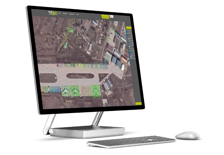
GeoSpace
Collaborative platform dedicated to integration, exploitation, visualization, analysis and sharing of geolocated data in a context of multi-source massive data.
- marketed since 2018
- Deployment in the places no internet connection required or and SAS
- Integration of a timeline for temporal tracking of activity on an image
- Allows the geoprocessing
- Processing and calculation of spectral bands
Site4i
It is a tool for vectorisation, storage et share items of interest.
It has a dedicated data model, in accordance with NATO STANAG 3596. It allows the versioning of sites according to the dates of shooting
Automated processing on an image and on vectors
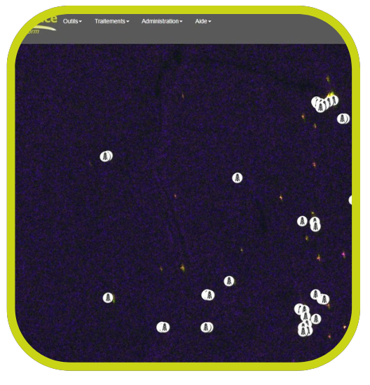
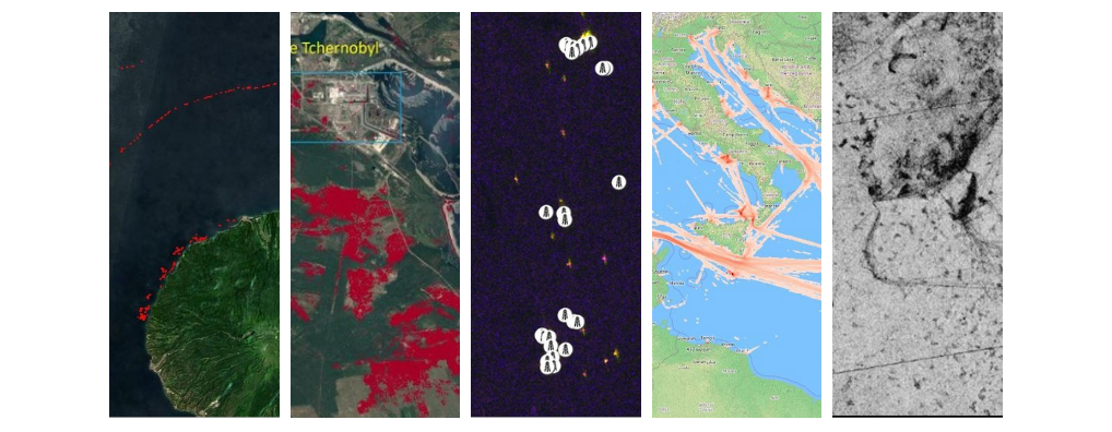
- Automatic detection of active lights (such as distress flares, Forest fires), burned areas, detection at sea (boats, plates-formes), oil spill, deforestation, plates-formes offshore, some.
- Automatic workflow on vectors :
- Maritimes from data AIS
- Aerial from data ADSB
- From data GPS
- From data IOT
- Auto Merge of data (example : RF data fusion & AIS)
- Highlighting human activity (radar imagery, automatic creation of consistency maps)
Automated processing chain

Wiktionary
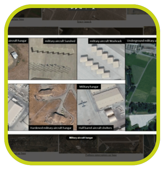
Help with interpretation by searching for pre-recorded elements in the form of a wiki

Recognition/Identification assistance tool
Help4i's goal is to help the analyst to carry out material identifications as easily and quickly as possible according to criteria such as length, the width, the form, the country…
The system was originally developed for the needs of Geo4i in its image intelligence work , now extended for sale.
The database of this tool consists several thousand pieces of military and civilian equipment selected , updated and administered by IMINT analysts with more than 15 years of interpreting experience.
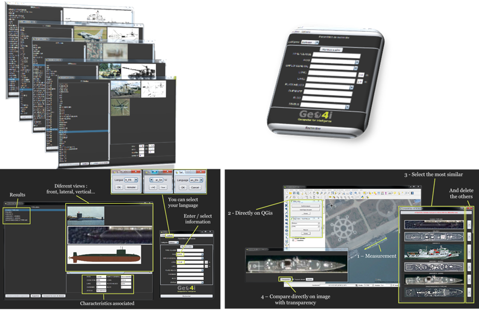
The use of the tool remains simple et intuitive.
It can be used only or connected geographic information systems QGIS or ArcGIS (with a plugin), and other systems on request.
Our database contains :
- Sea around 3 600 materials
- Air about 1 300 materials
- Earth about 1 250 materials
- Sol-air environ 115 materials
- Ballistic missile about 90 materials
- Radar about 80 materials
The vertical views materials from the Help4i database make the easy comparison.
The transparency and the superposition directly on the picture allow to confirm the identification or not.
Artificial intelligence
Artificial intelligence applied to satellite imagery makes it possible to provide support to analysts.
Named AI4I, this AI allows detection, a recognition as well as an identification of activity both on land, air than sea. It also allows the detection of sites of interest such as aerodromes, the ports, oil storage areas, dams etc.. All this on a single or multi-class model.
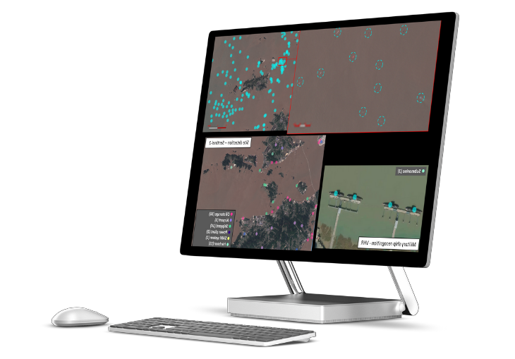
For the generation of detection models, recognition or identification of elements, this complete AI chain was therefore founded on the basis of 4 Additional modules.
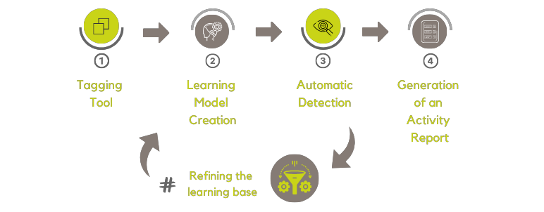
- Labeling tool : Dataset creation and class management (light vehicle, plane, ship, port site, …), creating vector masks.
- Learning model generation module : Train a model. Model being generated from the training set produced by the labeling tool and a neural network.
- Automatic detection : The detector uses one or more learning models and presents the detections.
- Activity report generation : Presents the various detector results in the form of a dashboard for local analysis (per website) or systemic (by country).
# Training Base Refined : Allows you to retrieve detection results and invalidate erroneous detections.

In order to obtain an even more efficient AI, THE AI data sets have been correlated with our Help4i tool.
- Stage 1 : AI detection an image from the Geo4i database.
- Stage 2 : The AI automatically creates a mask around the detected material to measure its length and width.
- Stage 3 : So, thanks to the measurements, Help4i will automatically suggest a suggestion list equipment identified by type.
- Stage 4 : The user has a accessibility and one total interactivity with the information sheets of the proposed list. The goal is to help identify elements of interest as much as possible..
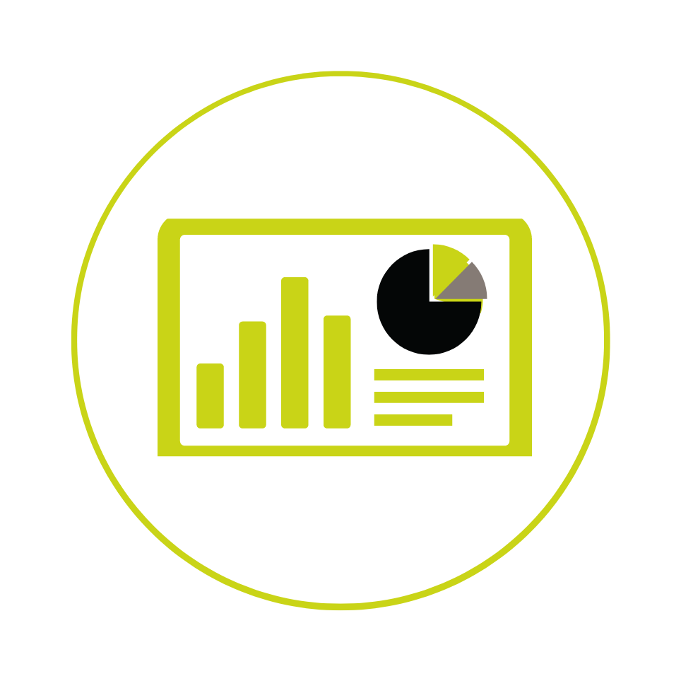
Dashboard
Dashboard allowing to visualize data in statistical form (chart)
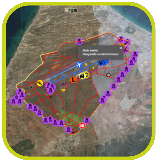
This part presents the different results of our detector as a dashboard for local analysis (per website) or systemic (by country) :
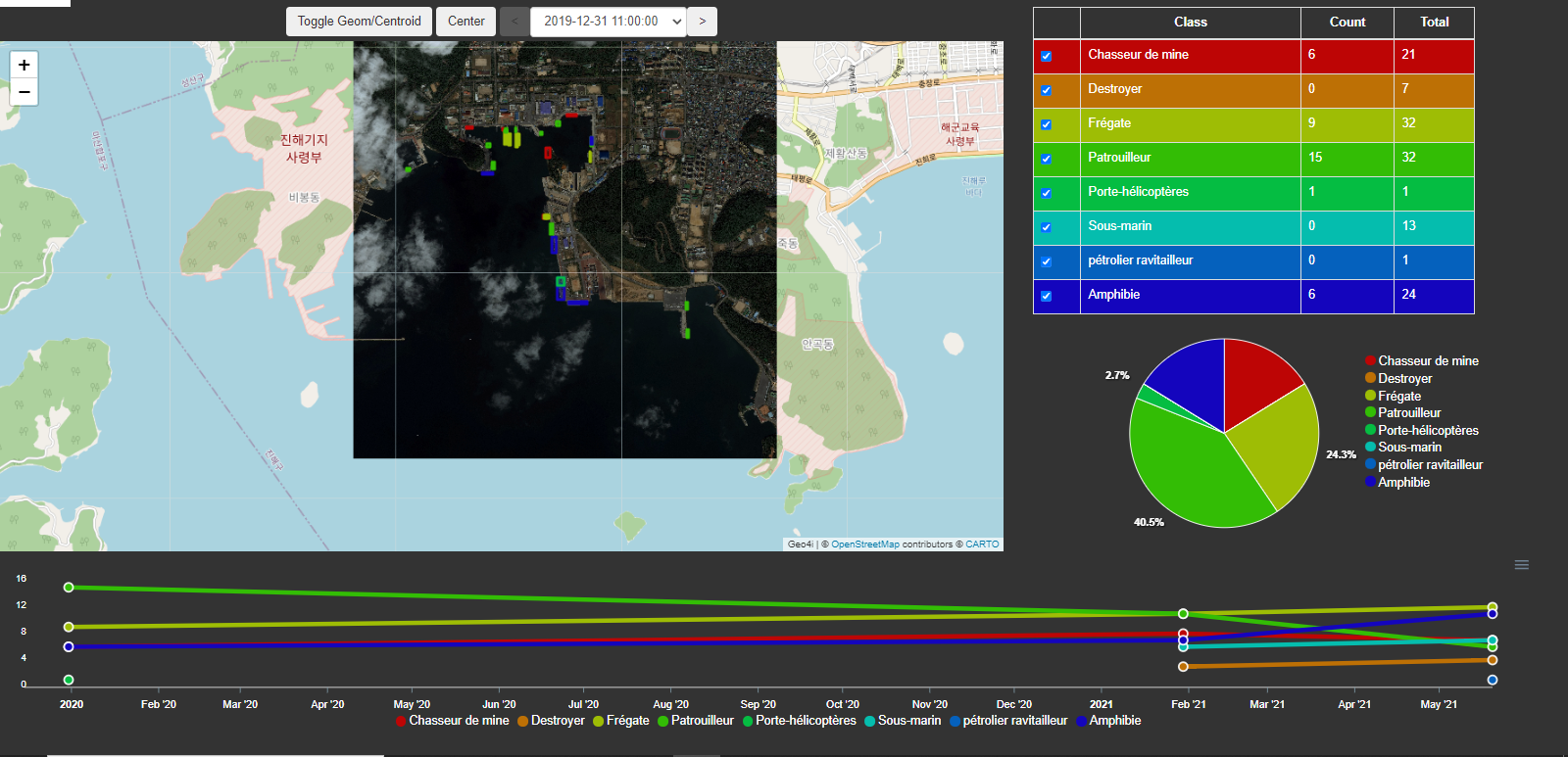
| Abilities |
| ◼ Creation of a project by geo zone (manual, image and/or site influence) ◼ Cartography (display of satellite images with associated detections, timeline) ◼ Related charts and interactive ◼ Cartographic part et graphs are linked together ◼Project update when inserting a new image with detections |